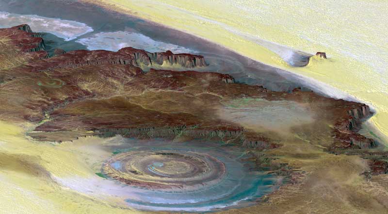
This prominent circular feature, known as the Richat Structure, in the Sahara desert of Mauritania is often noted by astronauts because it forms a conspicuous 50-kilometer-wide (30-mile-wide) bull's-eye on the otherwise rather featureless expanse of the desert. Initially mistaken for a possible impact crater, it is now known to be an eroded circular anticline (structural dome) of layered sedimentary rocks.
This is what you find when you clean up the papers hanging around the bedroom. The press release date was June, 2004, two years and I hadn't clicked the link. The Shuttle Radar Topography Mission's data is being used to study earthquakes, volcanism and erosion patterns.
One application of the SRTM imagery along with elevation data is monitoring the disappearance of the Mount Kilimanjaro glaciers. For more information go to http://www.jpl.nasa.gov/srtm .
2 comments:
I wasn't going to comment on this photo but just silently marvel at it. Oh, well, excessive verboseness (verbosity?) is one of my weaknesses.
The nature of the earth astounds me. And what astounds me more is the unique ability of Homo sapiens to appreciate such beauty. Wow.
Kurt, I didn't know whether to put this one up or the one of Cape Town. On this site you can take a flying tour of Africa as well.
Post a Comment